Latitude From Polaris Calculator
Correct a North Star altitude sight for eye-height dip, atmospheric refraction, index error, date-based polar distance, and rough hour angle.
Corrected Polaris latitude
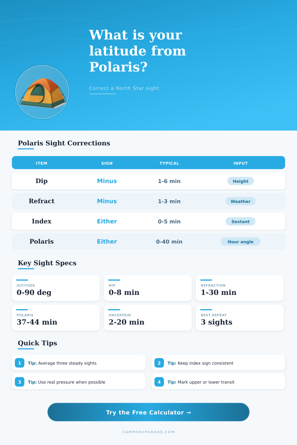
| Correction | Normal sign | Typical size | What drives it |
|---|---|---|---|
| Index correction | Either | 0 to 5′ | Sextant index error or instrument zero offset |
| Dip of horizon | Negative | 1 to 6′ | Eye height above the visible sea horizon |
| Atmospheric refraction | Negative | 1 to 10′ | Altitude, temperature, and pressure |
| Polaris offset | Either | 0 to 40′ | Date-based polar distance and rough hour angle |
| Reading uncertainty | ± | 1 to 20′ | Instrument, horizon quality, and repeated sight spread |
| Year | Polar distance | Upper transit effect | Lower transit effect |
|---|---|---|---|
| 2000 | 44.1′ | Subtract 44.1′ | Add 44.1′ |
| 2020 | 39.1′ | Subtract 39.1′ | Add 39.1′ |
| 2026 | 37.5′ | Subtract 37.5′ | Add 37.5′ |
| 2040 | 34.1′ | Subtract 34.1′ | Add 34.1′ |
| 2060 | 29.1′ | Subtract 29.1′ | Add 29.1′ |
| Rough hour angle | Where Polaris is | Altitude effect | Latitude action |
|---|---|---|---|
| 0° | Above the pole | Altitude high by full polar distance | Subtract polar distance |
| 60° | Upper side arc | Altitude high by about half | Subtract about half |
| 90° | East or west of pole | Little altitude effect | Almost no correction |
| 120° | Lower side arc | Altitude low by about half | Add about half |
| 180° | Below the pole | Altitude low by full polar distance | Add polar distance |
| Sight style | Good repeatability | Typical repeatability | Watch item |
|---|---|---|---|
| Marine sextant and clean horizon | 1 to 2′ | 2 to 5′ | Index sign and horizon dip |
| Artificial horizon sextant | 1 to 3′ | 3 to 6′ | Halving the measured double altitude |
| Tripod inclinometer or transit | 2 to 5′ | 5 to 10′ | Level setup and scale resolution |
| Handheld inclinometer | 5 to 10′ | 10 to 25′ | Hand motion and screen resolution |
Calculating your latitude by sighting the North Star, or Polaris, is an method of navigation that many people can use even though most peoples rely on GPS units to find there latitude. To calculate latitude with Polaris, you can take one sight of the North Star, but you must make several corrections to that raw latitude reading to accurately determine your latitude. The raw altitude of Polaris do not reflect your actual latitude due to several factor.
For instance, your eyes are at a certain height above the horizon; the higher your eyes, the more your line of sight are reflected off of the sea’s surface, making it appear as if the horizon is lower than it is. Additionally, the atmosphere refracts the light from Polaris; the light refracts such that Polaris appear higher in the sky than Polaris is in relation to the Earth. Furthermore, your measuring instrument may have some index error; Polaris does not sit at the celestial pole (it makes a small circle around the pole).
Find Your Latitude by Looking at the North Star
These factor all change the raw measurement of your altitude with Polaris; you must account for them in order to calculate your actual latitude. The calculator will mathematically calculate your latitude once you enters your measurements. You must enter your eye height into the calculator; the higher your eyes, the more dip in your measurement.
A person on a large ship will have a different eye height than a person on a small boat. Additionally, you must enter the temperature and air pressure measurement into the calculator; changes in the air pressure will change the amount of refraction of the light from Polaris. You must enter the date into the calculator to calculate the position of Polaris in relation to the celestial pole (it makes a small circle around the celestial pole).
Finally, you must enter the hour angle into the calculator; the hour angle will allow the calculator to adjust your sighting of Polaris according to that hour angle. Take three separate sightings of Polaris and average the three results. The three separate sightings will provide you with an idea of the stability of the horizon and your aiming of your sight line.
If your three separate altitudes for Polaris vary significant from one sighting to the next, you may be less certain of your calculated latitude. You may want to take the sightings at a later date. Some corrections are added and some is subtracted.
For instance, you subtract the dip value if you measure off of the sea horizon, but it isnt subtracted from artificial horizons. The refraction value is always subtracted because Polaris appears to be higher above the horizon than Polaris is above the horizon. The value for the position of Polaris can be either added or subtracted depending on whether Polaris is above or below the celestial pole.
Thus, you must have its addition or subtraction noted in the correction to the raw sighting of Polaris in order to accurately calculate the latitude. The Polaris method will work best if you have a general idea of your position. If your estimated position is significantly different than where you actualy are, then your estimate of the hour angle is likely to be incorrect, which will result in an incorrect calculated latitude.
Despite these drawback, the method is still a useful means of calculating your latitude if your GPS units fail. The weather conditions will affect the accuracy of your calculations. For instance, it is difficult to accurately sight Polaris off of a horizon that is obscured by haze or wave.
High air pressure creates steady air, which allows for more predictable calculations of refraction. Low air pressure result in turbulent air that can make it difficult to make accurate sight lines of Polaris. Thus, the weather conditions will change the uncertainty in your calculated latitude, but they will not eliminate the ability to use Polaris to calculate your latitude.
The reference tables will allow you to see the typical size of each of the corrections. For instance, if your estimated position is hundreds of meter from your actual position, the small error in your hour angle is likely not all that important. However, if you are taking your bearings to avoid a reef, the small error in your hour angle could be significantly dangerous.
Finally, the distance of uncertainty of your calculated latitude will allow you to determine if the calculations are likely to be accurate to the distance shown on the water. If the uncertainty in your calculated latitude is too great for your comfort level and the requirement for your trip, you may want to take more sightings of Polaris or wait for better weather. With experience using this system to calculate your latitude, you will have an idea of the relative importance of each of the corrections.
For instance, someone who travels on small boat will place an emphasis on eye height and horizon quality. Someone who is hiking to the mountains will place an importance on the impact of air pressure and temperature on higher altitude. The mathematics will be the same, but the importance of each correction will change with experience using this system to calculate your latitude.
Thus, the easiest means of calculating your distance from the equator is to sight Polaris in the night sky and apply the necessary corrections to that sighting. You should of used this method more often.