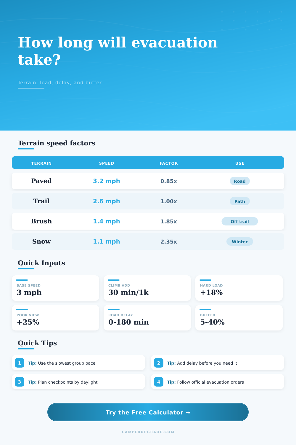
Evacuation Time by Terrain Calculator
Estimate walking evacuation time from distance, terrain, elevation, group speed, pack weight, visibility, staged delay, and planning buffer.
Evacuation estimate
| Component | Formula used | Typical range | Planning meaning |
|---|---|---|---|
| Base distance time | Distance divided by easy-ground base speed | 2.0 to 3.5 mph | Starts with the slowest realistic group pace |
| Climb penalty | 30 minutes per 1,000 ft gained | 0.5 hr per 1,000 ft | Naismith-style uphill allowance |
| Steep descent | 15 minutes per 1,000 ft difficult loss | 0 to 0.25 hr per 1,000 ft | Only for loose, dark, exposed, or slow descent |
| Terrain factor | Moving time multiplied by selected terrain | 0.85x to 2.75x | Models surface, obstacle, and route friction |
| Human factors | Group factor x load factor x visibility factor | 0.87x to 2.76x | Captures stops, pack weight, and navigation checks |
| Final total | (Moving time + delay) x buffer | 5% to 40% buffer | Produces a planning estimate rather than a best case |
| Terrain | Reference speed | Calculator factor | When to choose it |
|---|---|---|---|
| Paved road or campground loop | 3.2 mph / 5.1 km/h | 0.85x | Firm road, minimal obstacles, clear route |
| Gravel road or service track | 2.8 mph / 4.5 km/h | 0.92x | Roadbed is obvious but uneven or loose |
| Maintained hiking trail | 2.4 mph / 3.9 km/h | 1.00x | Normal trail with turns, mild roots, and signs |
| Rocky or rooty trail | 1.8 mph / 2.9 km/h | 1.32x | Foot placement slows the group each step |
| Muddy trail or wet meadow | 1.5 mph / 2.4 km/h | 1.58x | Slipping, boggy ground, puddles, or wet grass |
| Soft sand or dune path | 1.4 mph / 2.3 km/h | 1.72x | Beach, dune, wash, or loose volcanic cinder |
| Brushy off-trail travel | 1.3 mph / 2.1 km/h | 1.85x | Route finding through brush, blowdown, or tall grass |
| Packed snow or snowshoe route | 1.1 mph / 1.8 km/h | 2.35x | Winter track, snowshoes, icy attention, or cold stops |
| Urban stairs and crossings | 2.0 mph / 3.2 km/h | 1.22x | Stairs, curbs, signal waits, narrow sidewalks |
| Shallow water or debris wading | 0.9 mph / 1.4 km/h | 2.75x | Slow wading, debris fields, and careful footing |
| Factor type | Low value | High value | Use in the calculator |
|---|---|---|---|
| Group pace | 0.94x fit adult team | 1.38x assisted walker | Use the slowest member, not the average member |
| Load carried | 0.97x hands free | 1.32x bulky carry assist | Heavy packs compound fatigue on rough ground |
| Visibility | 0.95x clear signed route | 1.45x stop-and-check route | Darkness, smoke, or rain makes navigation slower |
| Fixed delay | 0 minutes | 180 minutes or more | Add staged departure, gates, congestion, and detours |
| Planning buffer | 5% controlled route | 40% high uncertainty | Buffer is applied after moving time and fixed delay |
| Route example | Distance and terrain | Elevation change | Typical calculated time |
|---|---|---|---|
| Campground loop to highway | 3.2 mi paved or gravel | 250 ft gain | About 2 hours with delay and 10% buffer |
| Trailhead exit from forest camp | 5.5 mi maintained trail | 900 ft gain | About 4 hours with a mixed adult group |
| Ridge route after storm | 4.1 mi rocky trail | 300 ft gain, 1,200 ft loss | About 4.5 hours with rain visibility |
| Beach access to high ground | 1.8 mi soft sand | 120 ft gain | About 1.5 hours with family pacing |
| Snow route to plowed road | 2.7 mi packed snow | 450 ft gain | About 4 hours with heavy winter load |
| Brush detour around washout | 1.6 mi off trail | 300 ft gain | About 2.5 hours with navigation checks |
Enter your route info into the calculator (above). Once you do, the app will calculate distance for you. Saving you a guesswork step (and saving all of us from a rush).
But it doesn’t stop there; the calculator goes beyond simply the straight-line distance on your map, to the distance beneath your feet. One mile across a paved road isn’t equal to one mile along a snowy ridgeline or through brush. The calculator add these terrain factors to slow the theoretical pace to real-world conditions. You’ll go fast on a paved surface, but thick brush or soft sand may halves your pace.
How to Plan Your Evacuation Route Safely
The most important factor is who else is joining. A common mistake is people thinking about how long they think they can go and assuming everyone else will be at that same pace. Big mistake. You need to use the pace of the slowest member of your party as a basis for your guess. Traveling with kids, elderly parents, injured friends, those all adds huge amounts of time. The calculator uses group pace factors to include those delays in overall speed. It makes you admit that traveling with others slows you down more than just going alone… something crucial when evacuating safely.
Momentum is reduced by load: Carrying a light daypack lets you keep moving steadily; cramming an emergency bag full of gear will slow you down. You must slows down every time you carry that heavy pack. The tool adjusts your starting speed based off the load factor you choose.
It is the same with visibility. Traversing a well-marked trail during daylight is no problem, while walking in darkness or smoke means constantly checking the route. All those halts adds up fast. Add in the non-walking time. When you hear an order come in, there’s always some lag time from then until you’re out the door. It can eat up an hour before you even start moving. With the calculator, you can add in that fixed delay to your travel time.
Next comes the planning buffer. That’s the last percentage that covers things you just don’t know. On a nice clear summer day, maybe a five percent buffer will suffice. In volatile conditions, a buffer of twenty-five percent or more is wise. This puts out the total time it will take and how much extra margin you have over your cutoff time frame. It also tells you how far apart checkpoints should be. This allows everyone to know when to hit key points so that morale stays up and no one gets lost.
If the estimated time isn’t within your safety window or daylight hours, then there is no way to walk this route. Plan B may include other means of transportation or being stuck in one spot. It all depends on terrain. Rocky trails require paying close attention with each step. Mud sucks at your boots. Snow requires careful foot placement and lots of breaks to warm hands and feet. You’ll be moving at least as slow as shown in the reference tables (on this page) when on rough terrain versus flat paved surface. Use these to check the sense of your input. For instance, if you select a rugged off-trail route and then choose a fast pace, you’re not going to add up.
The point of evacuation planning is to manage uncertainty. The weather/behavior of the fire isn’t up to you to control but your expectations are. Run the numbers ahead of time so that there’s no guessing when it matters most (i.e., during the panic). What does ‘I need to get this far within one hour’ look like? Under stress? Will there be a bunch of people around you also going? How fast will I move? And then plan to match that. A measured departure instead of a chaotic scramble.
Begin at the most difficult conditions. Assume the heaviest load and the poorest visibility. If it doesn’t work there, it won’t work if it is easier. It isn’t about speed. It’s about being out. Once, calculate. Often, verify. Always add in some margin for error. Your safety depends on knowing exactly where you stand before you ever take a step. Your life depends upon it.