Bushwhacking Time Penalty Calculator
Estimate how much off-trail cover, slope, footing, navigation, visibility, pack weight, and obstacle density slow a hiking route.
Fast line
Open forest, firm footing, simple bearing, and clear sight lines. Penalty usually stays close to 1.2x-1.5x.
Brush line
Young growth, wet stems, and repeated step-overs. Use moderate buffer because speed changes every few hundred yards.
Problem line
Blowdown, sidehill, loose footing, and poor sight lines. The model weights route-finding and obstacle density heavily.
Search line
Deliberate grids, frequent stops, and low visibility. Planned time is governed by control and coverage more than raw distance.
| Cover class | Typical terrain | Base factor | Route note |
|---|---|---|---|
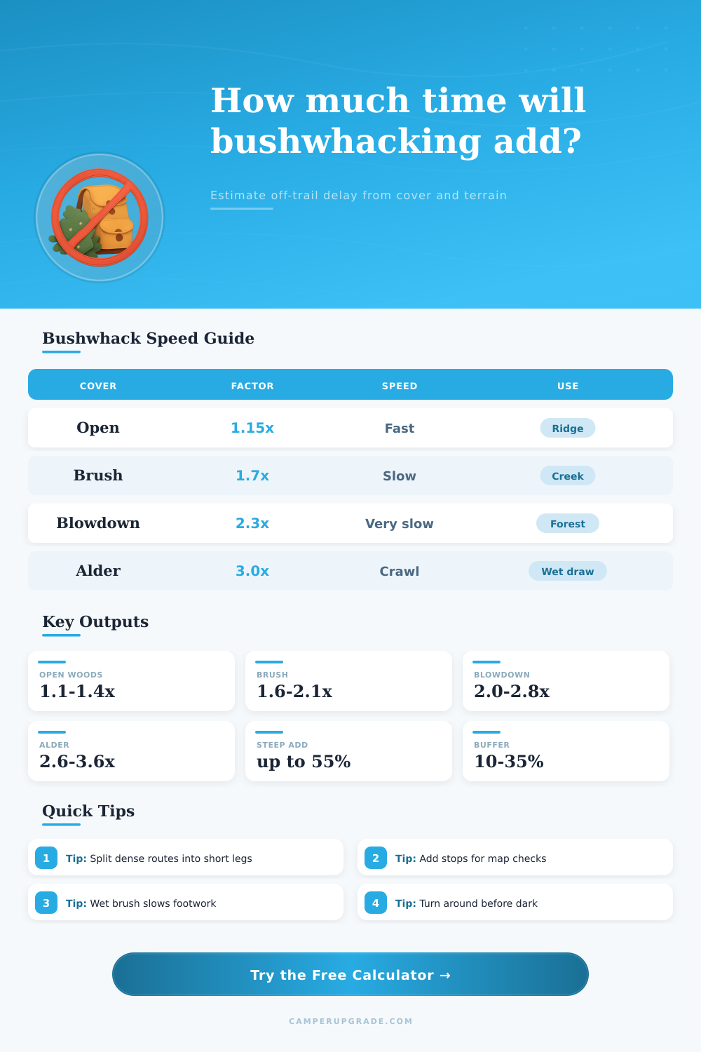
| Open woods | Meadow edge, mature forest, low talus | 1.15x | Mostly walking with small detours. |
| Light brush | Open understory, scattered saplings | 1.45x | Frequent weaving but steady movement. |
| Moderate regrowth | Young forest, waist-high brush, berry patches | 1.85x | Hands used often; pace becomes uneven. |
| Dense brush | Laurel, willow, manzanita, rhododendron | 2.40x | Short sight lines and constant route changes. |
| Blowdown | Stacked logs, storm fall, logging slash | 2.65x | Step-over count matters more than distance. |
| Alder thicket | Wet draws, vine maple, alder tunnels | 3.10x | Can become crawling speed in steep drainages. |
| Slope grade | Added factor | Common feel | Calculator use |
|---|---|---|---|
| 0-10% | 0-5% | Rolling or flat | Minor time impact unless footing is bad. |
| 11-25% | 6-18% | Noticeable climb or sidehill | Small stops and slower leg lift. |
| 26-40% | 19-32% | Steep forest, gullies, loose benches | Route choice becomes important. |
| 41-60% | 33-48% | Hands may touch ground or vegetation | Add margin for descent and exposure. |
| 61%+ | 49-55% | Very steep bush line | Model caps grade penalty; inspect terrain carefully. |
| Footing | Factor | Where it appears | Planning note |
|---|---|---|---|
| Firm duff or dry grass | 1.00x | Open forest, dry meadow | Cover controls most of the slowdown. |
| Loose rock or scree | 1.16x | Talus edge, eroded gullies | Expect careful foot placement. |
| Mud or marsh hummocks | 1.22x | Wet meadows, swamp edges | Short steps and detours add up fast. |
| Snow over brush | 1.28x | Spring routes, shaded basins | Hidden holes make distance less reliable. |
| Boulders or root maze | 1.20x | Creek beds, old-growth roots | Movement becomes balance-limited. |
| Navigation mode | Factor | Stop pattern | Best estimate use |
|---|---|---|---|
| Simple handrail | 1.00x | Occasional bearing check | Good for ridges, streams, and visible saddles. |
| Mixed navigation | 1.10x | Map or GPS every few minutes | Default for most off-trail legs. |
| Complex terrain | 1.24x | Frequent micro-route choices | Use with cliffs, gullies, and hidden benches. |
| Search grid | 1.42x | Deliberate spacing and notes | For slow coverage, not simple travel. |
That’s because you have a mental picture of the ridge line. It appear clean and you feel confident it can be crossed. It saves you two miles of switchbacks. The gain doesn’t look bad either. And the elevation profile show a straight shot. Seems like a smart shortcut.
Until you leave the trail. But then you realize you’re not hiking, you’re wading through molasses (holding your breath) as you walk through wet alder. Now you wish you should of done the math before lacing up. Friction is what off-trail travel are all about. It is not just about distance.
Why Off-Trail Walking Is Harder Than It Looks
Once you input your conditions into the calculator above, it do the math for you. So you don’t need to guess how much time that thicket is going to cost you, ten minutes or two hours?
Vegetation density are underestimated by most hiker. From far away, it appear sparse. In fact, it’s waist high. Suddenly you’re no longer striding forward; now you’re picking your way through branches. You’re pushing things out of the way with your hands, ducking beneath low-hanging limbs. You’re moving different, shifting work from your heart to your muscles. The tool addresses that with speed factors according to cover class: Open woods may only slow you a bit, but thick willows or laurel may make you three times slower. No joke. It’s physics. If each step involve negotiating an obstacle, you’ll go much slower.
Slope also matter, though it is only effective when combined with poor footing. Muddy hummocks or loose scree on a moderate grade are slow and dangerous (you’re always searching for good contact points), while a comparable steep grade on solid dirt is tiring but predictable. Because they don’t interact linearly, the calculator account for all this by combining their effects. Bad footing gets worse with steepness; heavy packs make everything harder; if you’re hauling thirty pounds of gear, it doesn’t matter as much on a paved road. It does matter more in a root maze where each lift demand stability you don’t have.
Visibility is another silent pace-killer. If you can’t see 50′ in front of you, how can you make plans on the next 5? You’re forced into reactive mode rather than proactive. That means stopping every few minutes to get bearings or identify clearings. The navigation complexity setting reflect that. A simple guide like a stream let you just keep moving. Complex micro-routes over gullies and cliffs force continual attention. And if it’s getting dark, the penalty go up again since your depth perception is gone long before you lose sight.
Always build in a buffer for uncertainty. It’s also an error to assume that all of your route are average for the whole thing. The cover isn’t usually dense all along. There may be ten minutes of open rock followed by thirty minutes of vine maple tunnel. By segmenting the leg into its parts and computing each part, you’ll get a better idea of what the overall average is; it represents an average speed, not the terrain type. To quickly pinpoint areas, use the reference tables on the page which will help you recieve information about the terrain feature or plant community that corresponds to the speed factor in the field. It come from field data.
So what is the main point? Bushwhacking is a give-and-take of effort versus miles. Sometimes walking through heavy vegetation takes longer then going around it on an established path. Use formula to determine whether the detour will cost too much time; if so, go around. In the backcountry, safety trumps efficiency.
Your numbers aren’t gospel. They’re there to inform your decision about which direction gets you moving again. That helps ensure that your trip doesn’t become a battle to survive. Make thoughtful decisions, follow the math not the topo lines, and then let the trees close up behind you.