Altitude Adjusted Pace Calculator
Estimate how elevation, climbing, trail surface, pack weight, acclimation, and weather change your route pace.
Altitude adjusted route estimate
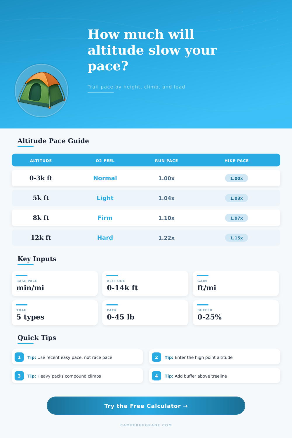
| Altitude band | Typical effect | Planning factor | Field note |
|---|---|---|---|
| 0-3,000 ft | Baseline oxygen availability for most lowland athletes | 1.00x | Use your normal easy pace. |
| 3,000-6,000 ft | Noticeable breathing change for hard efforts | 1.02-1.06x | Early miles may feel normal, climbs expose the difference. |
| 6,000-9,000 ft | Reduced aerobic ceiling and slower recovery | 1.06-1.13x | Control effort before sustained climbs. |
| 9,000-12,000 ft | Most sea-level visitors slow meaningfully | 1.13-1.23x | Plan extra stop time and conservative splits. |
| 12,000-14,500 ft | Thin air strongly affects pace and decision making | 1.23-1.35x | Use turnaround times and watch symptoms. |
| Trail profile | Multiplier | Best match | When to raise it |
|---|---|---|---|
| Road or paved path | 1.00x | Bike paths, park roads, smooth campground loops | Traffic, icy pavement, or frequent crossings |
| Smooth dirt trail | 1.04x | Well-built rolling trail with reliable footing | Dust, mud, narrow tread, or many switchbacks |
| Mixed singletrack | 1.09x | Normal mountain trail with rocks, roots, and steps | Night travel or tired legs |
| Rocky or rooty trail | 1.16x | Technical hiking or slow trail running terrain | Hands-on sections or loose exposure |
| Snow, scree, or loose talus | 1.22x | Unstable footing where each step gives back energy | Postholing, routefinding, or steep descent |
| Ascent density | Feet per mile | Route feel | Planning cue |
|---|---|---|---|
| Flat to rolling | 0-150 | Cadence stays near normal | Altitude and surface dominate. |
| Moderate climb | 150-350 | Regular breathing breaks appear | Keep effort below threshold early. |
| Steep mountain day | 350-650 | Hiking often beats running economy | Use poles or shorter steps. |
| Very steep route | 650+ | Vertical gain drives most of the schedule | Add buffer for descents and route checks. |
| Acclimation | Modeled relief | Who it fits | Use caution when |
|---|---|---|---|
| Arrived within 24 hours | 0% | Fly-in or drive-up visitors | Sleeping low and starting high. |
| 1-3 days at altitude | 25% | Weekend campers or short trips | Route goes much higher than camp. |
| 4+ days or regular exposure | 45% | Repeat mountain travelers | Recent illness or poor sleep. |
| Lives near route altitude | 60% | Local high-country runners and hikers | Heat, smoke, or unusually heavy packs. |
It doesn’t matter how fast you think you’re hiking getting out of valley floor takes its toll on your lungs. It’s like someone has taken a chunk of your chest with them and left it behind. Oxygen content decreases approximately one percent per three-hundred-foot increase in elevation. If you’re used to running at sea level, it’s no surprise that this can cause a bit of panic for most hikers. Before long, you’ll find yourself having to walk after only two mile. There simply isn’t enough oxygen for your muscles to power through hard run.
After plugging in the details of your route, along with your baseline speed, this calculator do the math for you (above). No more guesswork about whether that steep climb is going to cost you an extra 10 minutes or 40. Because it divides out the terrain penalty vs. Altitude penalty. A rocky trail impacts your mechanics… Shortening your stride; whereas higher elevation lowers your blood oxygen, impacting your aerobic engine. On its own, low oxygen makes you breathe hard. On its own, a rocky trail make you stumble. Together, they burn through your reserves quicker then either one by itself.
How to Use the Hiking Calculator
Begin with an attainable (not aspirational) baseline pace. It is not the split you got in last month’s 5K on the roads. Instead, assume the pace you could sustain while carrying on a conversation. If you use your best race pace as the input, what comes out looks reasonable yet still remains wildly over-optimistic when it come time to handle some altitude.
What the calculator does next is slap on a multiplier that factors in average elevation gain along your course. Your heart may be able to withstand a short sprint up to nine thousand feet or whatever for that killer view. But cumulative stress on the cardiovascular system will leave you spent fast if you hike a ridge line there for several hours. More than anyone admits, acclimation is important. You fly into altitude on Saturday morning and try to bag a summit on Sunday afternoon? Yeah, that’s not going well. And it won’t be fun either. It is a good thing the calculator includes lower penalties for gradual acclimation, which means spending days adjusting. But no matter how eager you are to go, the biology still requires 3-7 days for your blood plasma volume to expand. This metabolic mismatch lead to bonking, or total energy failure.
Note that pack weight matters because when you’re huffing and puffing, gravity is harder to overcome. It’s vital to carry enough food and water for safety at high elevation, but each additional pound make it harder to move efficienty. For this reason, the model incorporates a pack weight drag factor (climbing with a full hip belt is much more difficult than wearing a hydration vest). A mere 10 pounds might not sound like much until you find yourself sucking wind lifting those legs six-hundred times in one steep mile. Also, technical trails requires increased attention, they’ll take more oxygen per step than a smoother path through dirt.
Numbers don’t always completely represent this other dimension: weather. At elevation, the protective layer of air around you is thinner and less insulating, sapping heat from your core faster with cold winds. Humidity changes things here as well; while the lack of humidity makes evaporative cooling efficient, it will also quickly dehydrate you. This alters the way your body distributes its available energy between muscle power and regulating temperature.
Build some contingency into the plan. Weather changes. Legs tire unexpectedly at altitude. Routes gets re-routed. Planning some leeway for unplanned stops or wrong turns keeps you from having to make snap decisions in the dark. You’re not racing; you’re trying to get there safe and in one piece with plenty of stamina to appreciate what you’ve seen.
Trust the new pace it gives you, even though your ego wants to keep pushing. Estimates aren’t challenges, they’re guard rails. Listen to the thin air, it’ll ease you past. Disregard it and it’ll whisper precisely how high above sea level you are. You should of planned for more.