Hiking Hydration Bladder Refill Calculator
Estimate how much water to start with, how many bladder refills to plan, and whether the longest dry stretch fits your carrying capacity.
🥾Trail Hydration Presets
⚙Refill Planning Inputs
Use the full route distance, including side trips to water sources.
Moving time drives the main sip rate estimate.
Break time is counted at a lower drinking rate than hiking time.
Group results multiply the per-hiker water need.
This sets the base liters per hour before weather adjustments.
Use the warmest expected hiking temperature, not the morning low.
Higher humidity can raise the practical sip rate.
Open routes dry you out faster than shaded routes at the same temperature.
Dry high-elevation air and breathing effort can increase water demand.
Include food, water, clothing, and carried group gear.
Common bladders are 1.5 L, 2 L, and 3 L.
Enter what you plan to leave the trailhead with in the bladder.
This is treated as full at the start and available during dry stretches.
Reserve is held back for delays, missed sources, or a hot final mile.
Count only sources you expect to be flowing or cached for this route.
Measure from the last sure water to the next sure water.
Raises planned carry for seasonal flow uncertainty or slow filtering.
Gravity filters, squeeze filters, tablets, and pumps vary widely.
Optional planning value for drink mix or salt caps; follow product labels.
This calculator is a planning estimate for healthy adults on typical hikes. Weather, medical needs, acclimatization, water quality, and local conditions should override the estimate.
Hydration Bladder Refill Results
📊Hydration Planning Factors
📘Reference Tables
| Route condition | Typical planning rate | Adjustment trigger | Refill note |
|---|---|---|---|
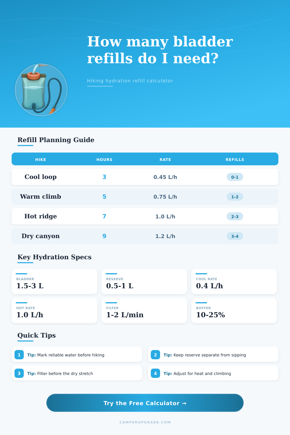
| Cool forest trail | 0.35 to 0.55 L/hr | Below 60 F, shaded tread | Start full or near full for short loops |
| Moderate warm hike | 0.55 to 0.85 L/hr | 60 to 85 F, mixed sun | Check every mapped stream or tap |
| Hot exposed route | 0.85 to 1.25 L/hr | Open sun, dry air, glare | Refill before the bladder feels low |
| Hard climb or heavy pack | 0.75 to 1.1 L/hr | Steep grade, slow miles | Carry by time, not just distance |
| Winter cold route | 0.35 to 0.65 L/hr | Cold air, insulated bottle risk | Keep hose from freezing when possible |
| Bladder setup | Useful capacity | Best for | Refill planning read |
|---|---|---|---|
| 1.5 L bladder | 1.2 to 1.5 L sipping | Short cool hikes | Needs frequent sources in heat |
| 2 L bladder | 1.6 to 2 L sipping | Most day hikes | Good balance of weight and range |
| 3 L bladder | 2.4 to 3 L sipping | Dry stretches and groups | Can start partly filled on wet routes |
| Bladder plus bottle | Bladder plus 0.5 to 1 L | Backup and drink mix | Separates reserve from hose sipping |
| Soft flask add-on | 0.3 to 0.7 L extra | Fast hiking or trail running | Easy to fill at shallow trickles |
| Water source spacing | What to check | Carry strategy | Risk flag |
|---|---|---|---|
| Every 1 to 2 mi | Flowing creek or tap | Partial refills may be enough | Filter failure still matters |
| Every 3 to 5 mi | Seasonal reliability | Refill before leaving each source | Hot days shrink the safe range |
| Every 6 to 8 mi | Longest climb and shade | Use full bladder plus backup bottle | Missed source may require bailout |
| More than 8 mi | Cache, permit, or alternate | Plan full dry-carry capacity | Do not rely on hopeful water |
💡Refill Planning Tips
If you know how far it is between water sources (ie: How long of a stretch without water), then you can actualy plan for it correctly. The problem with many hikers pack to begin with is that they don’t figure out where the real gaps in sources are and wind up lugging more water than necessary around. It’s equally silly to assume there will always be water when you need it, which results in rationing water during a hot climb because that creek you were relying on was more like a trickle.
Once you plug in your pack weight, temperature, sun exposure, moving time, and route distance, the calculator do the rest. It calculates how fast you’ll lose water, since things like your pack weight, the sun, the temperature, and the steepness of the climb all change that rate. A moderate climb in mixed sun at seventy-eight degrees is already different than the same distance in full shade at fifty-eight. Add a heavier pack and more altitude and the rate increases even more. The tool rolls all of that into one adjusted sip rate, and it tells you how much water that require during your expected move and break times.
How to Plan Your Water for Hiking
Then you run it through and see if your initial fill + planned refills is enough water to get through the furthest dry section before you start drawing from the reserve. And that is there for a reason. It’s your buffer, something you leave alone till you truly need it. Maybe filter is slower than expected. An extra hot afternoon when temps rise higher then predicted. Maybe you miss one of your sources. But by keeping that reserve separate from your sipping supply (to help you think about usable capacity instead of just the total bladder size on label), the calculator account for only what you can realy use.
People think in terms of total water and then stop. You want to know where that number breaks down, where you get to a distance from a reliable source beyond which math fails. The page lays out planning rates for various conditions, as well as shows how bladders differs in terms of range vs. Weight. In general, an average gap between sources remain within the safe range for a day hike with a two-liter bladder. High heat, reflective rock, and longer days makes the bladder feel cramped. At that point, you are likely stretching your gaps beyond five or six miles.
You’ll find that filtering time has more influence than hikers like to acknowledge, and that a slow filter make even a brief pitstop a lengthy wait. The waiting itself will alter your intake. With this, the calculator include a slight time penalty per refill. After making that tweak, can you still fit everything within the remaining daylight? If you are tracking electrolytes separately from plain water intake (and many hiker do), then this is an optional field. Your sodium loss increases alongside sweat rate so if you’re monitoring that independently of total water consumption, there’s a space for you.
Running it out beforehand also reveals which route can be ran given the gear you have in hand without any guesswork. Either you know your bottle and bladder are going to last through the loneliest stretch with room to spare, or you discover exactly where something won’t work. Before you’re 20 miles down the trail, you change the route, you change the carry load, or you change the starting time. One check should of made the difference between having some idea of being ready and knowing you’ve got a plan.