Grid Distance Calculator
Measure straight-line grid distance, route-adjusted leg length, and compass-ready bearing between two coordinate points.
📍Route Presets
⚙Grid Inputs
📊Grid Navigation Spec Grid
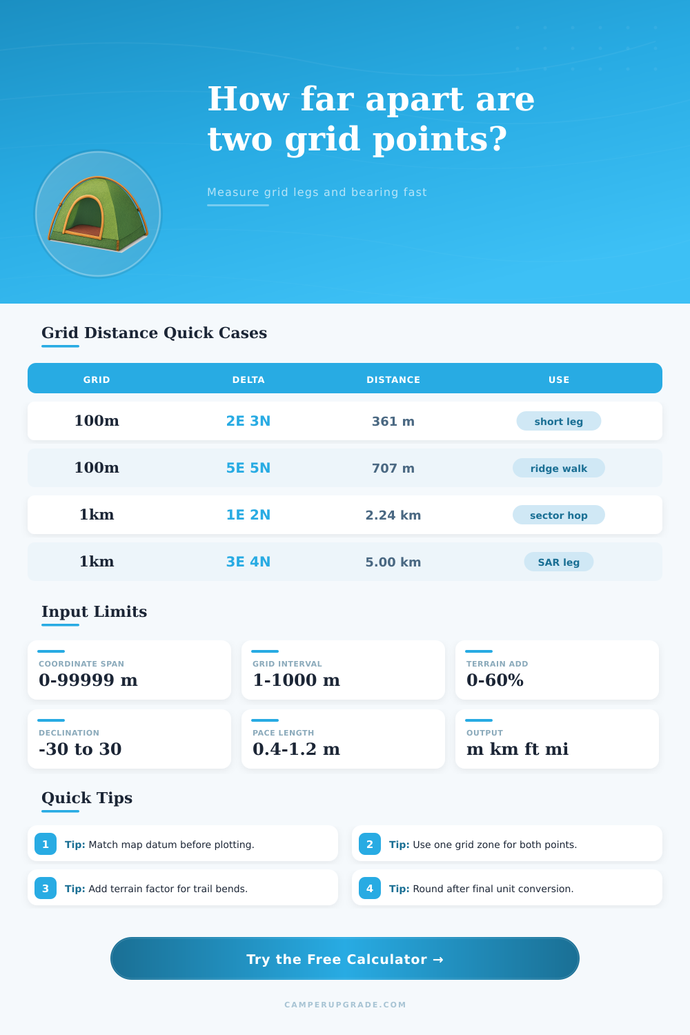
📘Grid Distance Reference Tables
| Delta East | Delta North | Straight Distance | Grid Bearing |
|---|---|---|---|
| +100 m | +100 m | 141.4 m | 45.0° |
| +200 m | +300 m | 360.6 m | 33.7° |
| -500 m | +800 m | 943.4 m | 328.0° |
| +1200 m | -400 m | 1264.9 m | 108.4° |
| Grid Interval | 1 East + 1 North | 3 East + 4 North | 5 East + 5 North |
|---|---|---|---|
| 50 m | 70.7 m | 250.0 m | 353.6 m |
| 100 m | 141.4 m | 500.0 m | 707.1 m |
| 250 m | 353.6 m | 1.25 km | 1.77 km |
| 1000 m | 1.41 km | 5.00 km | 7.07 km |
| Adjusted Leg | Pace 0.70 m | Pace 0.75 m | Pace 0.80 m |
|---|---|---|---|
| 500 m | 714 paces | 667 paces | 625 paces |
| 1000 m | 1429 paces | 1333 paces | 1250 paces |
| 2000 m | 2857 paces | 2667 paces | 2500 paces |
| 3500 m | 5000 paces | 4667 paces | 4375 paces |
| Scenario | Straight | Terrain Add | Adjusted Leg |
|---|---|---|---|
| Forest line check | 1.2 km | 15% | 1.38 km |
| Open ridge traverse | 2.8 km | 8% | 3.02 km |
| Dune crossing | 1.6 km | 20% | 1.92 km |
| Snow approach leg | 3.4 km | 25% | 4.25 km |
Grid distance is a measurement of the distance between two point on a map. Grid distance is used to plan the route that an individual will take when traveling across the terrains. The grid distance between a persons current position and there destination will not necesarily match the actual distance that the person will travel due to the presence of various terrain obstacles that will require the person to take a route that isnt directly from one point to the other.
To compensate for the distance that a person must travel around these obstacle, the individual must adjust that distance to reflect the true distance that will be traveled. Grid coordinates can be used to determine the distance between two points on a map. These coordinate include the easting and northing of the point on the map.
Plan a Route Using Grid Distance
The easting represent the distance of a point from left to right on the map, while the northing represents the distance of a point from the bottom to the top of the map. These coordinates are represented in a series of six-digit number. Furthermore, these coordinates can be used to calculate the straight line distance between two points.
However, because the calculation of the straight line distance does not account for terrain, the individual will also adjust that distance for terrain in the same way as the grid distance between the two points. The straight line distance between two points can be adjusted for terrain by applying a terrain factor to that distance. A terrain factor is a percentage that represents the additional distance that a person must travel to move from one point to the next due to the terrain.
For instance, if a person is traveling on the open prairie, the terrain factor may be five percent. However, if a person is traveling through the woods, the terrain factor may be twenty percent due to the difficulty of movement through the forest. The adjusted distance can be used to calculate the number of step that a person will need to take in order to travel from one point to the next.
The number of steps that a person takes to cover a specific distance is referred to as the persons pace count. The individual calculates the pace count by dividing the adjusted distance by the pace length. An individuals pace length is the length of their stride in meter.
The pace length of an individual is approximately seventy-five centimeters. Furthermore, an individuals pace length can change due to fatigue or while walking on different type of terrain. Thus, an individual must monitor their pace length to ensure that the pace count is accurate.
In order to determine the direction of travel for an individual, the bearing of a destination can be determined. The individual can calculate the grid bearing of a destination with the grid coordinates of the persons current position. This bearing will be represented in degrees.
However, the individual must subtract the magnetic declination of the area from the grid bearing to determine the magnetic bearing of the area. Magnetic declination is the difference between magnetic north and grid north. If an individual does not account for magnetic declination, they will drift from their plotted course.
A calculator will adjust for magnetic declination automatically, but the user must set the declination to the correct number for the area in which the individual will be traveling. An individual can also estimate the length of time that will be required for the individual to travel from one point to the next by calculating their travel speed. An individual can estimate their travel speed in kilometer per hour.
However, the individual must adjust their travel speed based on the terrain. For instance, an individual traveling on flat terrain at a normal pace may travel at the rate of four kilometer per hour. However, if the individual is traveling on rough terrain, they may only be able to travel at two kilometer per hour.
By knowing the adjusted distance between the two location that an individual will travel and by knowing their adjusted travel speed, the individual can calculate the length of time that will be required for them to travel from one location to the next. An individual must be careful not to commit common error when using grid distance and grid coordinates. One of the most common errors is using different datum for the coordinate system.
Using different datums will result in inaccuracies of the calculated coordinates. Another of the most common errors is ignoring the effect of terrain on an individuals pace length. An individuals pace length will be shorter if they are walking uphill or through sand.
Finally, an individual must remember that magnetic declination changes every year. Therefore, an individual must check the magnetic declination for the specific area in which they plan to travel. An individual can use grid distance to calculate the distance that they will travel between two points on a map.
Based off the distance between the two points, the terrain factor, and their pace length, an individual can calculate the number of step that they will need to travel from one point to the next. Furthermore, by calculating the adjusted distance from one point to the next, the bearing of their destination, and the length of time that it will take for them to reach that destination based on their travel speed, an individual can successfully plan a route for traveling from one point to the next on the map while accounting for the actual terrain of that area.