Map Scale Ratio Calculator
Convert map measurements to real ground distance, run reverse planning, and adjust for print resize and slope so route legs stay accurate.
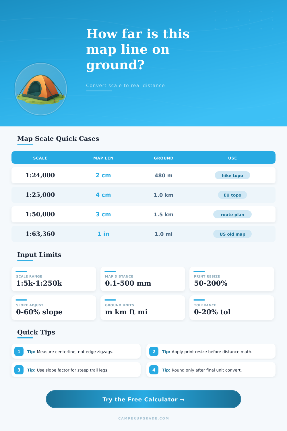
🗺Navigation Scenario Presets
⚙Scale Ratio Inputs
📊Scale Quick Grid
📘Reference Tables
| Map Scale | 1 cm on Map | 1 inch on Map | Typical Use |
|---|---|---|---|
| 1:10,000 | 100 m | 833 ft | Park detail mapping |
| 1:24,000 | 240 m | 2,000 ft | US hiking topo |
| 1:25,000 | 250 m | 2,083 ft | EU mountain topo |
| 1:50,000 | 500 m | 4,167 ft | Regional route plan |
| Map Length | 1:24,000 Ground | 1:25,000 Ground | 1:50,000 Ground |
|---|---|---|---|
| 1 cm | 240 m | 250 m | 500 m |
| 2 cm | 480 m | 500 m | 1.0 km |
| 5 cm | 1.2 km | 1.25 km | 2.5 km |
| 10 cm | 2.4 km | 2.5 km | 5.0 km |
| Print Resize | Effective 1:24k | 1 cm Ground | Planning Impact |
|---|---|---|---|
| 80% | 1:30,000 | 300 m | Distances read short |
| 90% | 1:26,667 | 267 m | Moderate shrink error |
| 110% | 1:21,818 | 218 m | Distances read long |
| 125% | 1:19,200 | 192 m | Large zoom correction |
| Ground Leg | Scale | Map Mark Needed | Notes |
|---|---|---|---|
| 1.0 km | 1:25,000 | 4.0 cm | Common topographic grid |
| 2.5 km | 1:24,000 | 10.4 cm | Long ridge traverse |
| 3.0 mi | 1:63,360 | 3.0 in | Old US one-mile scale |
| 800 m | 1:10,000 | 8.0 cm | Short detail route |
Map scale is the ratio of the distance on the map to the distance on the ground. An map with a large denominator will show a larger area on the map but will have less detail. A map with a small denominator will shows a smaller area on the map but will have more detail.
Maps can contains numerous errors. One source of error is that maps are flat representations of the three dimension of the Earth. Because maps are flat, they cannot account for slope in the Earth’s terrain.
How to Use a Map Scale
These slopes will make the distance that someone walk on the ground be longer then the distance on the map. Another source of error is the print process for maps. If a printer resizes a map when printed, then the scale of the map will no longer be accuratey.
Therefore, if a person prints a map and adjusts its size, they must adjust their calculation to account for this. When using a map, a person must account for several factor. First, the person must account for the scale denominator.
Second, the person must account for the size of the print map. Third, the person must account for the slope of the ground being map out. For example, a person can use the grade of a slope to calculate the distance a person will travel on the ground instead of the flat distance on the map.
If a person ignore these factors, they will underestimate the time and effort necessary to travel the route on the map. Many people makes mistakes with map scales. One of the most common mistake is to measure the edge of a trail instead of the center of the trail.
Measuring the edges will provide a longer measurement of distance than the trail actualy is. Another mistake is using old maps that uses different unit than the metric system. Finally, people often make mistake with warped ruler.
To avoid this error, people should break their route into smaller segment to avoid accumulating these error. A person can use reference grid to make measuring distance on a map easier. Reference grids contain line on the map that provide a measurement of real-world distance.
For example, a map that is to scale at 1:25,000 will have lines that are two centimeter long that represent one kilometer of real world distance. A person can use these measurement to avoid having to calculate the distance between two point on a map. Finally, a person should include some tolerance within the distance that they plan to travel on a map.
Tolerance is the error that a person include in their distance calculation. A ten percent tolerance is usually enough for small measurement error to be accounted for without making the scale too inaccurately for the map. Overall, a person must remember that a map is a model of the world, not the world itself.
A person must adjust for the scale denominator, the size of the printed map, and the slope of the terrain that they will travel. If a person make these adjustments, they will have a more accurate understanding of the distance and time necessary to travel the route on the map.