🚴 Monon Trail Distance Calculator
Plan your walk, jog, or bike ride along Indianapolis's most popular greenway — from downtown Indy to Westfield.
| Location | Mile Marker | Parking | Amenities |
|---|---|---|---|
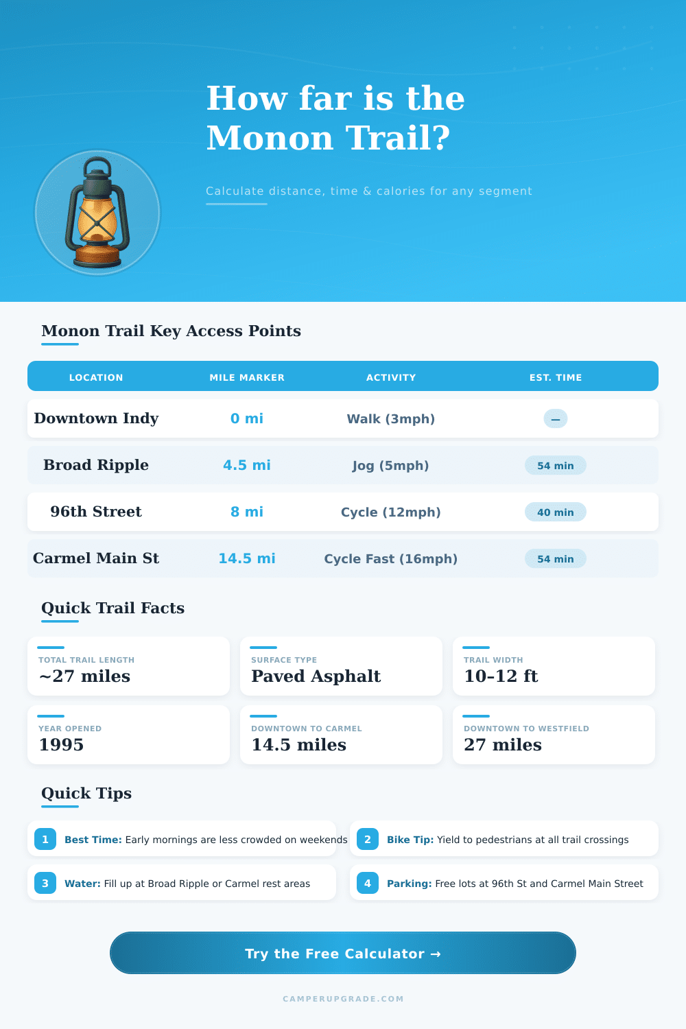
| Downtown Indianapolis (10th St) | 0 mi | Yes (paid) | Restaurants, shops |
| Broad Ripple Village | 4.5 mi | Yes (free) | Restaurants, water |
| Glendale Town Center | 6 mi | Yes (free) | Shopping, restrooms |
| 96th Street | 8 mi | Yes (free) | Water fountain |
| Carmel Arts & Design District | 13 mi | Yes (free) | Galleries, dining |
| Main Street Carmel | 14.5 mi | Yes (free) | Shops, restrooms |
| 146th Street Carmel | 16.5 mi | Yes (free) | Limited |
| Westfield Grand Junction | 22 mi | Yes (free) | Park, water |
| Westfield City Center | 27 mi | Yes (free) | End of trail |
| Segment | Walk (3mph) | Jog (5mph) | Cycle (12mph) |
|---|---|---|---|
| Downtown → Broad Ripple (4.5 mi) | 1h 30m | 54 min | 22 min |
| Downtown → 96th Street (8 mi) | 2h 40m | 1h 36m | 40 min |
| Downtown → Carmel Main St (14.5 mi) | 4h 50m | 2h 54m | 1h 12m |
| Downtown → Westfield (27 mi) | 9h 0m | 5h 24m | 2h 15m |
| Broad Ripple → Carmel (10 mi) | 3h 20m | 2h 0m | 50 min |
| 96th St → Westfield (19 mi) | 6h 20m | 3h 48m | 1h 35m |
The Monon Trail ranks among the most popular paths of Indianapolis and whole Indiana. It stretches more than 28 miles through the center of the state linking the capital to Sheridan in the north. The path starts at 10th Street in the downtown and winds through different neighborhoods and suburban areas, until it arrives in Sheridan at the limit between Hamilton and Boone counties.
The path passes through some wooded parts. It goes from south to north through Broad Ripple, Carmel, Westfield and finally to Sheridan. Only in Westfield it covers 7.92 miles.
Monon Trail from Indianapolis to Sheridan
In Carmel there are 5.2 miles of that path, while Indianapolis has around 10.4 miles. The part from 10th Street until 96th Street goes across the heart of Indianapolis, before feeding into Hamilton county.
After aruond 6 miles, the path arrives at Broad Ripple. It is a nice neighborhood with a vivid red bridge and active cultural life full of restaurants and galleries. From here north to Carmel, the next few miles form a suburban gallery lined with trees and local sculptures.
The Distance between Carmel and Broad Ripple is made up of almost four miles of shady and smooth way for walking, with little human activity.
One rates the path as easy in rise. It stretches nearly 27 miles with total change of 528 feet. To finish it on foot takes around 8.5 until 9 hours.
The surface of the way stays nice during the whole length. Under 116th Street is a slope, that can feel thrilling or a bit scary according too the experience of folk.
The way starts beside the SoBro zone close to the Monon House and goes north until the finish, what covers nearly 30 miles for a trip. Some use 20 miles of the Monon Trail for everyday commute, together with added runs or walks. The bit between 46th and 10th Street does not offer as much to see compared to other sections of the path.
There is also the Monon Trail South, that forms a separate 57-mile path between Mitchell and the border of Clark and Floyd counties. It would link eight southern Indiana communities. Right now, the Monon Trail South splits into 5 separate parts, that store 18.5 miles.
More plans for growth are planned for the Monon Trail from 10th until 96th Street, especially between 14th and 56th Street. Near options include the Cultural Trail in the downtown and the Wapahani Trail at White River, that offers moreshade and is less used than the Monon Trail.